i wish u to add this features in the next version...
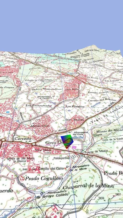
1- 3D MAP VIEW option with multiple choices of DEM [IMPORTANT] (especially that this application specializes in topography and highlands !)
2- ability to display layers in specific level
ex:
i want to display a layer in zoom 15,16 only..
3- Opacity display in landmarks
thx
The support forum is temporarily read-only. For urgent requests, please email contact[at]psyberia.net
[closed] some proposed additions
-
Psyberia-Support
- Site Admin
- Posts: 6390
- Joined: Wed Apr 14, 2010 9:41 pm
Re: some proposed additions
Hi again and thanks for your suggestions.
For 1), I'm currently working on offline elevations. It won't be a 3d map for now, but at least you'll be able to get elevation anywhere and get elevation profiles.
For 2) you can already do that. All maps/layers available in the application are based on text files (XML markup), and you can freely edit them to remove or add levels. To get the file of a map, long press it (from the maps explorer list) and select "Details". Check the "Data file" section. The config file has the same name but ends with ".aqx". Be sure to restart the app after any editions. Here are more details for the config file format, and let me know if you have any question.
For 3), you can already change the opacity for landmarks. In the "Edit color" form, you can also change the opacity. You can do that for all landmarks from the application settings, or per landmark by clicking on it and on "Edit color".
Do you like AlpineQuest ? Leave a small comment on Google Play !
-
Ramadnio
- Posts: 46
- Joined: Sat Dec 12, 2015 3:34 pm
Re: some proposed additions
1) 
this is a photo of 3d map from another app on android...
i think it's very simple just.. the idea in DEM data..
2) good but i talking about landmarks and custom map layers like (RMaps)
3) Done.
this is a photo of 3d map from another app on android...
i think it's very simple just.. the idea in DEM data..
2) good but i talking about landmarks and custom map layers like (RMaps)
3) Done.
-
Ramadnio
- Posts: 46
- Joined: Sat Dec 12, 2015 3:34 pm
Re: some proposed additions
?
for now i need no. (2)
for now i need no. (2)
-
Psyberia-Support
- Site Admin
- Posts: 6390
- Joined: Wed Apr 14, 2010 9:41 pm
Re: some proposed additions
For 2 so no you cannot do that, if you use a map with 3 zoom level, the application will use all of them.
But I don't understand why you don't want to see some layers...
For 1, maybe someday why not...
But I don't understand why you don't want to see some layers...
For 1, maybe someday why not...
Do you like AlpineQuest ? Leave a small comment on Google Play !
-
Ramadnio
- Posts: 46
- Joined: Sat Dec 12, 2015 3:34 pm
Re: some proposed additions
i talking about the additions what i hope to see it in coming versions
so i wish to see this feature no. (2) in landmarks as soon as
thank u
so i wish to see this feature no. (2) in landmarks as soon as
thank u
